Saturday, October 26, 2013

223) Muloorina - Always Check Your Ducks!


A slightly demonic-eyed Gibberbird (you've got to impressed by these guys, living the hard life on the gibber plains of Central Australia--you'd have hard eyes, too!)
Our 'real' desert driving had started, we were on the lookout for the 'real' desert birds of trip.  So, we 'really' wanted to see Gibberbirds--that meant we were 'really' in the Outback because Gibberbirds live on the Gibber Plains. What is gibber?  Although the dictionary definition of gibber is "to speak rapidly and unintelligibly," gibber (with the 'g' pronounced like the 'g' in 'gum') is also the aboriginal word for 'rock.'  The Gibber Plains of Australia can be extremely inhospitable, but we saw it at a 'friendly' time of year and found it fascinating--it is a form of desert pavement.  The rocks are left when the sand and dust are blown away in the desert winds, but they polish the stones to a smooth roundness as they leave. 


GIBBERBIRD
range map for Gibberbirds


This is a gibber plain - hardly what we would have thought was "good habitat!


Gibber 'pavement". Although this is all pebbles with mud/dust cemeting them, it is not very hard. Its a bit spongy to walk on and would be a slow-go to drive, and destructive, as well--compressing it down would be de-stabilizing.


We were thrilled to spot a few Inland Dotterels at dusk as we eked all the birding we could out of the waning light as we drove towards Muloorina Station where we planned to camp.

Inland Dotterels have mastered the art of camouflage.  With their back to us, their mottled feathers blend into the multi-hued gravel.  Facing us, the stripes on their breast appear to be the dark sticks of a small bush. Interestingly, we found out that they eat seed and leaves during the day, and switch to eating bugs at night--they are mostly nocturnal, presumably to escape the heat.  


Much of the land (almost all) along the Birdsville and Strzelecki Tracks belongs to cattle stations (i.e. 'ranches), in part because the tracks were established to move cattle!  Camp at Muloorina is at a man-made wetland/lake that has become a haven for birds.  Explorers found they could bore (drill) into the Great Artesian Basin (which underlies parts of Queensland, New South Wales, South Australia, and Northern Territory) and it became a reliable water supply, enabling the establishment of cattle stations in the interior of Australia. 


We arrived in the dark and had a great camp under a full moon.  We could see ducks paddling around in the lake, spreading sparkles of moonlight.


There was only one other camper in this lovely spot.  The owners of Muloorina station kindly provided the opportunity for us to stay there, even providing an outhouse and fire rings for us.  Our payment for the camping at the 'honesty box' went towards the 'Flying Doctor Service'--opportunities for medical attention are few and far between out here, so this is an important community service.


Canoodling Galahs

Galahs became a constant - anywhere there was water  they were present in large numbers. Always pretty is the first and last light.....
Black-tailed Native-Hens


Pink-eared Duck


Early morning birding revealed this party of native-hens.  Wonder what a male Native-hen is called?!  


We (re)learned a critical birding lesson - always check your ducks! We saw a lot of coots, Pacific Black ducks and Hardheads - all fairly common. But then - - what is that? It's a pair of Pink-eared ducks hiding out among the more common fowl! They are rare (though as we were to find, they can be locally common) and due to a skittish nature, Dirk spent considerable time trying to get a decent picture


Two Pink-eared Ducks
They'd take flight if we got too close (and this photo was taken with a big lens)


Black-fronted Dotterel


Variegated Fairy-wren (Purple-backed race)


Variegated Fairy-wren (Purple-backed race)


We're always happy to see the cheeky Fairy-wrens.  There are several sub-species of Variegated Fairy-wrens, so these guys are members of a ssp we've never seen.


We left Muloorina (indigenous name meaning 'shady place') for an 'out and back' drive in the desert towards Kati Thanda-Lake Eyre.  We saw more flowers in the desert than you might imagine, though it IS springtime, so why not?!  Regrettably, we don't know any of their names except for the last one...


...appropriately-named Fried Egg Flowers!


Camera-man in action with the bird's eye view of Kati Thanda-Lake Eyre.


Kati Thanda-Lake Eyre (south)- heat and salt....
Recently, the lake had various amounts of water in it due to heavy rains between 2009 and 2011.  The best way to see the spectacle with all the birds who migrate here (when there is water) is to see it from overhead in a small airplane.  It must have been a sight!
 
Map of Kati-Thanda-Lake Eyre drainage
The lake has an enormous catchment (above) and was renamed in Dec 2012 to reflect its indigenous name 'Kati Thanda', which means '"the name of the lake which was formed after the skin of a kangaroo was spread over the ground." Some of the land surrounding the lake was returned to Native Title in May of 2012.

Late breakfasts were the norm, since we always had to get up at first light to look for birds.  Here Dirk is whipping up a breakfast feast in the (empty) parking lot at Kati Thanda-Lake Eyre, after driving from Muloorina.


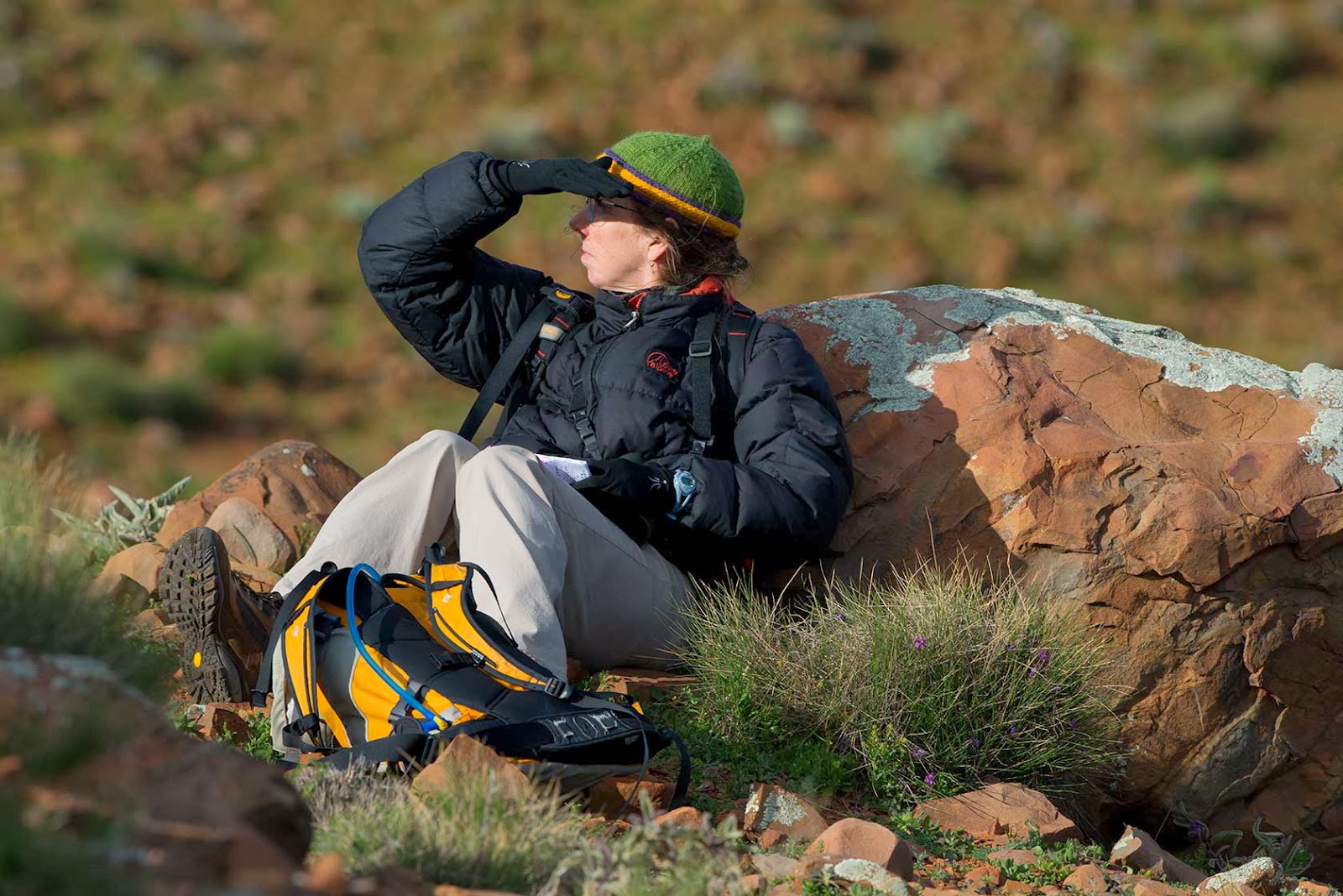
High fashion in the desert includes a fly-headnet.  There must have been a breeze at this point, the headnet is in place over the hat, ready to come out as needed.


contemplating Kati Thanda-Lake Eyre
sand, sand everywhere!
Freckled Duck

We drove back by the lake at Muloorina for one last look - wait.... that's a Freckled Duck!!!! - a real rarity. Remember - always check your ducks!


Brolga

Four Brolgas were hiding out at a small bore where we stopped to check for birds.  Lots of cow-trampling, few birds.  But it was kind of in the middle of the day so we couldn't expect much.


We could see this sculpture, in the middle of 'nowhere',  from miles away--the ground was so very flat.  It must have been made by some creative soul that had access to a forklift.
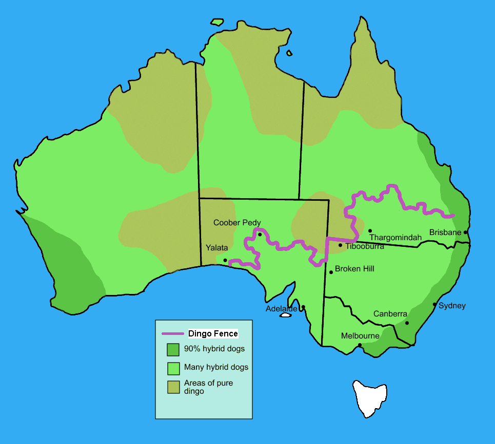
Dingo fence
According to Wikipedia, "The Dingo Fence or Dog Fence is a pest-exclusion fence that was built in Australia during the 1880s and finished in 1885, to keep dingoes out of the relatively fertile south-east part of the continent (where they had largely been exterminated) and protect the sheep flocks of southern Queensland. It is one of the longest structures in the world and is the world's longest fence. It stretches 5,614 kilometres (3,488 mi)."


We're facing the wrong direction according to the sign, but really, we're headed to Birdsville!


Wednesday, October 23, 2013

222) Stakeout in the Flinders


Redthroat ! Wow...

We ran into a local bird guide - her utterly  classic response to  us telling her we spotted a (rare) Redthroat was "are you sure it wasn't a Red-capped robin?"

Actually yes - this is what a Red-capped Robin looks like! Our Redthroat was most emphatically NOT a robin.

We headed to the Stokes Hill area east of the park in search of one bird - the Short-tailed Grassswren. We stayed at a working cattle station that has camping facilities where, due to some misunderstanding about unmarked one-way roads and unwritten rules of where we could (not) go, we left feeling punk and shall not return, as there are far more pleasant options close-by. 

Southern Whiteface
But we also saw some great birds - an input error into the GPS lead us the wrong way, but we encountered some nice looks at a Southern Whiteface, and many thornbills.


We also saw numerous examples of the tree-clearing practice of girdling - to clear land for more cows (more grass grows if there are fewer trees?), the bark is cut and the tree dies. We have seen an unfortunately large number of these, it seems to be a common practice - 


We got back to our camp and cleared up all the "what the hell do you think you were doing.." attitude and made it to Stokes Hill (where we had been trying to go as that was what the map they gave us said...sigh)

Here we walked and sat ...and listened...

.listened....and sat and walked. But the wind was pretty bad for locating grasswrens (who were undoubtedly undercover in the spinifex) and we eventually called it quits and headed out.

Its no fun to dip... (twitcher slang for failing to find a specific bird you go to an area to find). But then these are an endangered species ... 
The Finders Range National Park is another former pastoral property undergoing rehabilitation
Some old homestead ruins.....

Interesting petroyglyphs

and a great geology drive across the anticline


We spent another night at the north end of the park in a blissfully-empty campsite (except for the birds!) where we saw the Redthroat.  We had Ringneck parrots, honeyeaters, kookaburras and a whole family of Babblers to keep us company.


A long distance view of an Elegant Parrot (yes, that's their name!)


and a wonderful Black-breasted buzzard!


Yellow-footed Rock Wallaby


We made a special trip through Brachina Gorge where a small population of Yellow-footed rock wallabies live.  Check out that gorgeous stripey tail!


Unlike their nomadic kangaroo breathren, rock wallabies creche their young and are restricted to rocky slopes and cliffy areas. This made them an easy hunting targets until they reached critically low populations. This population is protected in the Park.  They are glorious critters to watch as they effortlessly float across huge boulder-fields.


We finally pushed on into the sunset and days of flat horizons, dirt tracks and dust......


 Out here there be monsters.......